


giswire News
Home | News
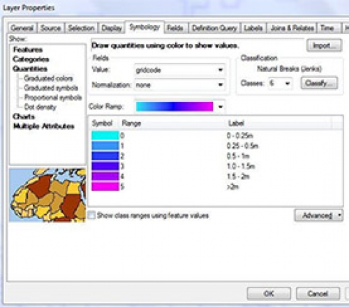
Preparation of OPW Fluvial Flood Extent & Depth Data
13th Nov 2017
Prepare the CFRAMS (Catchment Flood Risk Assessment and Management) mapping deliverables from the Office of Public Works (OPW) for Kildare County Council for consumption by Local Authority staff on their native GIS.
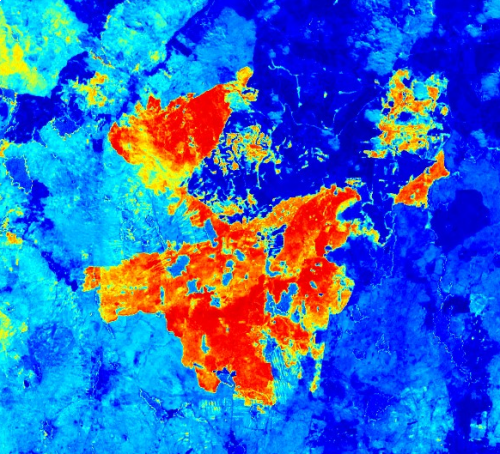
Wild Fire Investigation Open Source Data and Software
21st Aug 2017
2017 has seen many wildfires rage across the Irish countryside, with a significant number of these receiving much media attention for the devastation they have caused to rural environments. A large number of these wildfires have occurred in upland areas in counties such as Wicklow, Galway, Kerry and Donegal.


